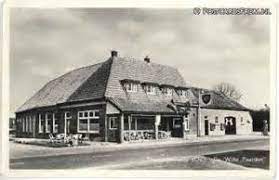
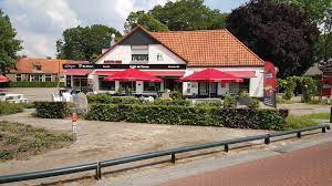
The hamlet of White Horses (with the Pondemaat) is named after an old inn with that same name. It was a famous inn on an old road from North to South. It provided pleasure of all sorts for everyone ‘on the road’ in earlier times. The notion of ‘white’ seems to relate to that of a ‘white elephant’ or a ‘white raven’. It would imply a sign of luck, since such ‘white’ animals are rare. True or not, that is the story that we like to tell. Still, among other things, due to its location de Pondemaat can be called the high(est) point of Willemsoord.
The hamlet is situated between the towns of Steenwijk and Wolvega, and between the closer smaller towns of Steenwijkerwold (the forests of Steenwijk) en Willemsoord (the town of Willem, second king of the Netherlands).
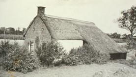
The spot where our now ‘renewed’ farmhouse stands was the place of an old small farmhouse where landless city people were given a plot of land, some two hundred years ago (www.welkomtoenwelkomnu.nl). It was development thinking based on what is known as ‘the enlightenment era’. The settlement constituted a rural development scheme which has partly become UNESCO world heritage. Remains of that era are still clearly visible around our ‘farm’ and in the neighbouring town of Willemsoord.
Three-country point
A three-country point (or rather ‘three province point) is where three provinces meet (Friesland, Drenthe and Overijssel). For those who know the country it is the easiest way to locate White Horses and Willemsoord on a larger map. That ‘meeting point’ itself lies some six kilometers behind the Pondemaat, between forests and farmland on the edge of an old medieval estate (https://www.deeese.nl/).
The landscape
All this implies that we live in an area where different landscape types come together, with their associated differences of histories. To the North one finds the Friesians and the Stellingwerfs in both upland and lowland areas areas. To the East live(d) descendants mainly of the Saxons, often on higher sandy soils. To the South one finds the mainly lower lands of people that ‘belonged’ to the bishops of Utrecht. We like to talk and hear more about these ‘things of the past’ as well as about the future of these lands and people. We are concerned about the place of rural communities in overall development.
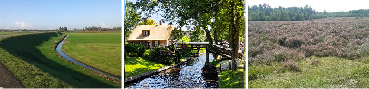
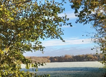
Big boulders lie around ‘de Pondemaat’, brought in by glaciers from Scandinavia. Also, remains of mammoths are found, while deer and nowadays even wolves are part of modern local wildlife (http://www.theehuis-tuk.nl/) to the East behind the Pondemaat. To the South, sort of facing ‘de Pondemaat’, the landscape slopes down some 10 meters (the glacier’s morraine) with a very special old agricultural landscape, ‘carved’ by mixed farming systems. It is a beautiful landscape from an agricultural history point of view. From that slope one has a view of the lake area around Giethoorn, with peat plains used for grass- and cropland but also with much reclaimed nature land and wildlife (https://www.visitweerribbenwieden.com). To the Northeast one crosses a varied landscape with restored nature, old peat lands and crop lands, the Friesian forest region.
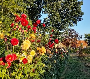
The direct surroundings of the home are special too. Easy to reach by highway or cycling roads, with pastures and/or cropland on all sides and with forests very near by. The garden fits in quite well with those surroundings, especially (of course) in summer.
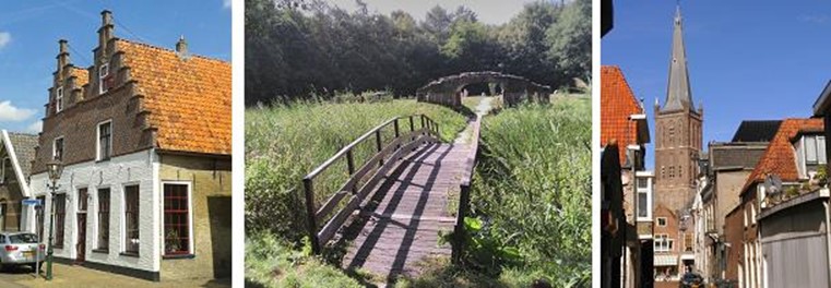
Steenwijk town
Steenwijk itself is an old settlement that controlled East-West traderoutes from Germany to the old port of Staveren (then situated on the sea coast) a 1000 years ago. In the later middle ages Steenwijk was an important base for the Utrecht Bishop, to control the swampy Northern areas. Later the town became important in the control of South-North routes. No wonder that is was the fourth important city that was fought over between the new republic and (then) Spanish rulers. That was after the sieges of Leiden, Haarlem and Alkmaar when the 80-years war was fought (1568-1648). Contours of the fortress city are still very much present in Steenwijk and in nearby coastal towns like Blokzijl. The swampiness of the area also invited religious refugees such as Anabaptists (and/or Mennonites). And the Clemens church in Steenwijk was even a beacon for sailors at sea. The coastal areas still clearly bear evidence of a history with pirates, fishermen and floods, a great area for touring by cycle and on foot.